Evolution of a regional map
April 9, 2021
rpg d&dLast month I wrote about our new D&D campaign in the homebrew world of The Fading Lands, and the map I put together for it using the fantastic Inkarnate. We've now started the second arc or chapter of the campaign, and I thought it would be good to collate the various iterations of the map in one place. In using Inkarnate, we are able to return to the map to add new locations and features as we explore this world over time - Inkarnate makes that easy.
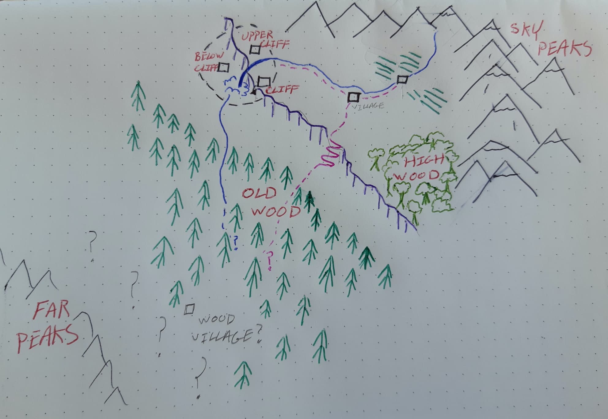
The original
Here's how it began... as a sketch of the starting area from our DM. It included our starting "village" and some nearby locations of interest which, in true RPG player fashion, we still haven't explored 🙂
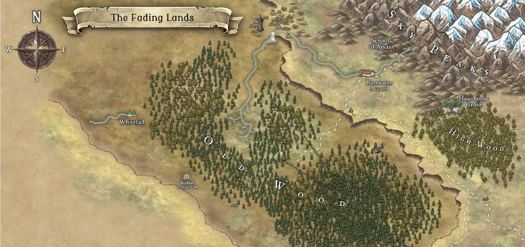
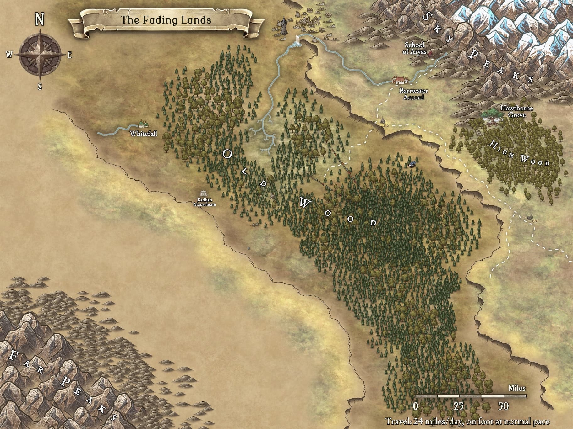
First edition
The first iteration (or should I say inkarnation?) of the map covered the key starting locations for our party - our elven ranger hails from Barrwater Accord, our genasi monk from the nearby School of Aryas in the lower foothills of the Sky Peaks, and our firbolg druid from the Hawthorne Grove in the High Wood.
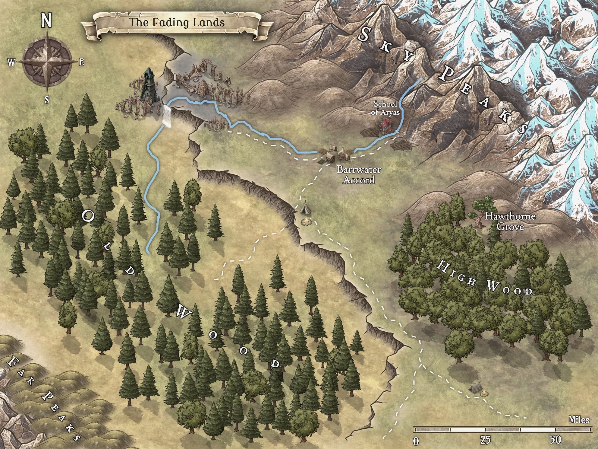
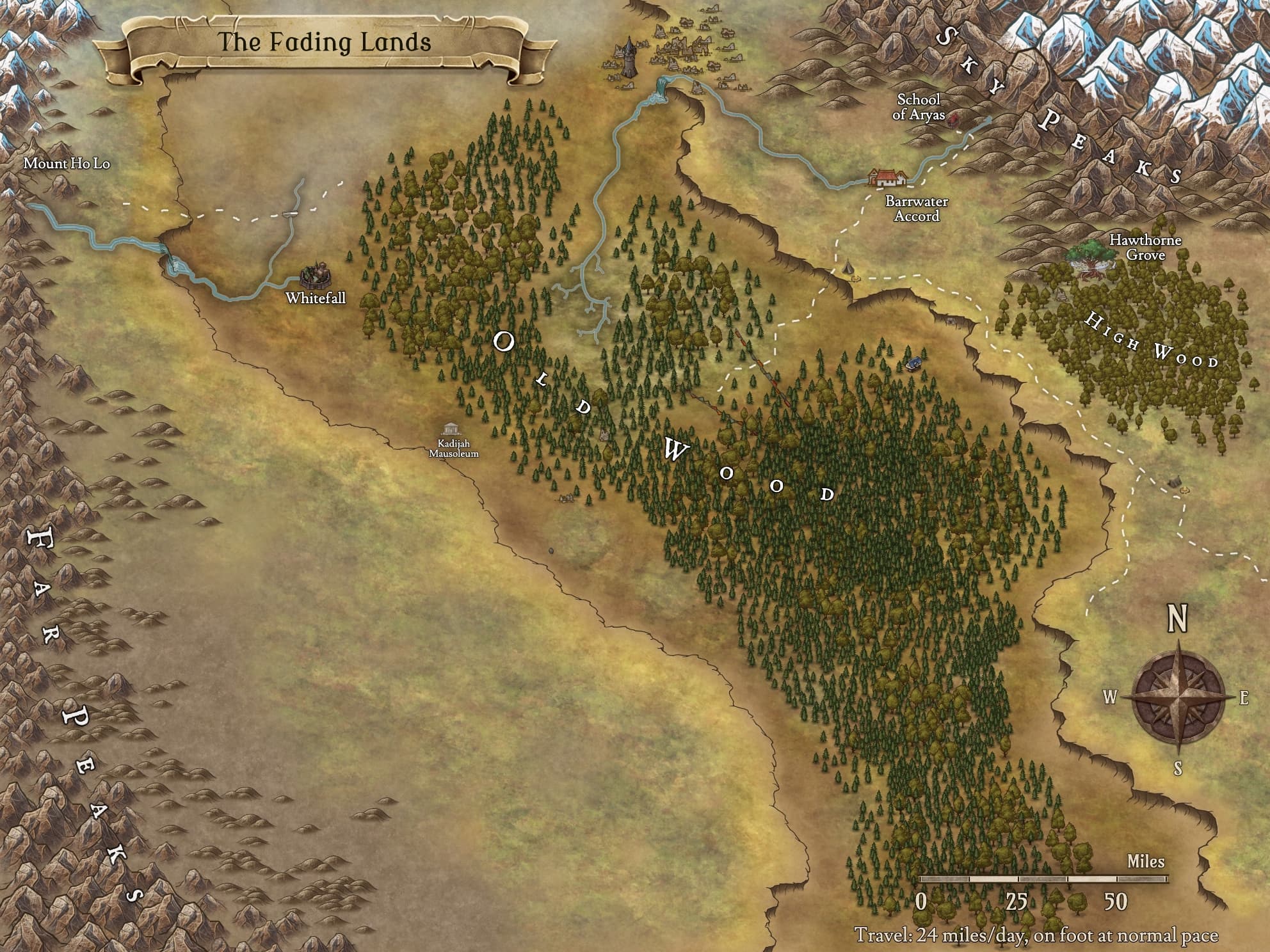
The Widening
The first iteration looked nice and went down well with the group, but it wasn't quite to the scale our DM had intended. For a start, they had envisioned a much greater distance between the Old Wood and the Far Peaks. This reworked second attempt looks incomplete but gave us all a yearning to explore more of the region south and west of the Old Wood.
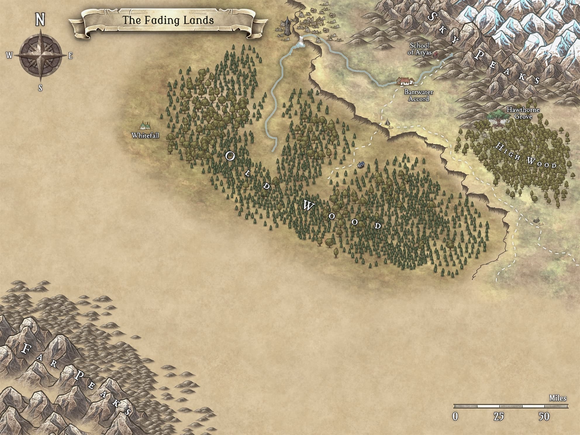
Whitefall
The climax of our first chapter found us on the south west side of the Old Wood, discovering an ancient mausoleum and the settlement of Whitefall in the plains between the edge of the forest and the southern cliffs.
Into the Far Peaks
In the second chapter of our campaign, our party returns to Whitefall briefly before embarking on a new quest to investigate the reported use of forbidden technology near Mount Ho Lo in the Far Peaks. This has resulted so far in the discovery of more nearby waterways and a bridge over a dilapidated, ancient trade route that seems to run from The Old City in the east, to parts unknown in the west...
Woops, we blew up the mountain
OK, so we went to Mount Ho Lo, then we went inside Mount Ho Lo. Then, we may have contributed to the blowing up of a third of Mount Ho Lo. So, I went back and changed a mountain peak into a volcano...

Both the original and current maps are shared on Inkarnate.
Last edited on September 22, 2021.